AI-Optimized Marine Navigation Systems: A Practical Guide
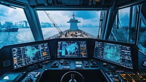
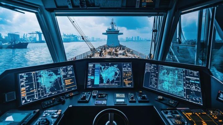
AI-optimized marine navigation systems combine navigation data, sensors, automation, and machine learning to support safer and more informed vessel operations.
AI-optimized marine navigation systems use artificial intelligence alongside established maritime technologies to help interpret information about a vessel and its surroundings. These systems can process data from radar, electronic charts, positioning equipment, weather information, cameras, depth sensors, and vessel instruments.
The objective is not simply to automate navigation. It is to help identify patterns, detect potential hazards, improve route awareness, and support decisions made by qualified maritime personnel.
Modern systems may use machine learning, computer vision, sensor fusion, predictive analytics, and automated decision-support functions. More advanced applications are also being developed for remotely controlled and Maritime Autonomous Surface Ships (MASS).
Why AI Is Being Applied to Navigation
Marine environments can change quickly. Weather, currents, traffic, visibility, shallow waters, and unexpected vessel movements can all affect navigation.
AI can process large amounts of information rapidly and present relevant information in a form that supports human decision-making. However, AI does not remove the need for appropriate navigation procedures, human oversight, equipment reliability, and compliance with maritime rules.
Why AI-Optimized Navigation Matters
Supporting Safer Maritime Operations
Navigation technology affects commercial vessels, passenger vessels, research ships, ports, offshore operations, and other maritime activities.
AI-based systems can assist with:
- Collision-risk awareness
- Route planning and monitoring
- Object and vessel detection
- Weather and sea-condition analysis
- Anomaly detection
- Situational awareness
- Predictive equipment monitoring
- Navigation data integration
These capabilities can be particularly useful when operators must interpret information from several systems at the same time.
Improving Data-Based Decision Making
Traditional navigation already depends on electronic charts, radar, positioning systems, and established procedures. AI adds another analytical layer by examining relationships between different data sources.
For example, computer vision can help identify objects, while sensor-fusion algorithms can combine radar and camera observations. Predictive models can also identify unusual patterns that deserve additional human attention.
The reliability of these systems depends on data quality, sensor performance, software validation, cybersecurity, and appropriate human supervision.
Recent Updates and Developments
IMO MASS Code in 2026
A major development occurred in May 2026, when the International Maritime Organization (IMO) adopted the International Code of Safety for Maritime Autonomous Surface Ships. The non-mandatory MASS Code took effect on 1 July 2026. It establishes a goal-based international framework for autonomous and remotely controlled cargo ships and works alongside existing maritime safety requirements.
The development followed substantial regulatory work during 2025. At MSC 110 in June 2025, IMO progressed multiple chapters of the MASS framework, including areas involving risk assessment, connectivity, human factors, and navigation.
Maritime Digitalization
In March 2025, IMO's Facilitation Committee approved a work plan for developing a broader Maritime Digitalization Strategy. The initiative addresses emerging technologies, standards, safety, and environmental considerations across maritime activities.
These developments indicate that AI-enabled navigation is increasingly being considered within formal maritime safety and digitalization frameworks rather than as a purely experimental technology.
Laws and Policies
International Maritime Rules
AI navigation remains subject to established maritime safety requirements. The MASS framework is supplementary to instruments such as the International Convention for the Safety of Life at Sea (SOLAS). Autonomous capability does not automatically remove a vessel from existing maritime obligations.
The Convention on the International Regulations for Preventing Collisions at Sea (COLREGs) is also important because navigation systems must support appropriate collision-avoidance behavior.
United States Regulatory Developments
In June 2026, the U.S. Coast Guard published work instructions concerning oversight of unmanned, autonomous, and remote-controlled maritime operations. The guidance addresses how Coast Guard personnel evaluate different autonomous and remote-control operations within the Marine Transportation System.
Regulatory requirements can vary according to vessel type, operating area, autonomy level, and applicable national and international rules.
Tools and Resources
Useful Technology Categories
People researching AI marine navigation can examine:
- Electronic navigational chart systems
- Automatic Identification System data
- Marine radar and target-tracking systems
- Weather and ocean-condition datasets
- Route-planning software
- Computer-vision platforms
- Sensor-fusion frameworks
- Maritime traffic simulators
- Cybersecurity assessment frameworks
- Navigation training simulators
- Autonomous-vessel testing environments
For research and education, maritime regulations, navigation manuals, technical standards, simulation datasets, and academic papers can provide useful background.
FAQs
What is AI-optimized marine navigation?
It is the use of artificial intelligence and data-analysis techniques alongside conventional marine navigation technologies to support navigation awareness, route analysis, hazard detection, and operational decisions.
Can AI completely replace a human navigator?
Not generally. The level of autonomy depends on the vessel, technology, operating environment, regulations, and approved operating procedures. Human oversight remains important in many maritime applications.
What data does an AI navigation system use?
Depending on its design, a system may use radar, electronic charts, positioning data, cameras, depth measurements, weather information, vessel traffic data, and onboard sensors.
Is autonomous shipping already regulated?
Yes. IMO adopted the non-mandatory MASS Code in May 2026, which entered into effect on 1 July 2026. Further work is planned toward a future mandatory framework.
Does AI navigation eliminate maritime safety rules?
No. AI-enabled or autonomous navigation remains subject to applicable maritime safety, navigation, environmental, cybersecurity, and vessel-specific requirements.
Conclusion
AI-optimized marine navigation represents an important development in maritime technology. Its applications range from decision-support and route analysis to computer vision, autonomous systems, and remote operations. The technology can help process complex navigation information, but its effectiveness depends on reliable data, validated systems, cybersecurity, human oversight, and regulatory compliance.
The 2026 IMO MASS Code represents a significant step in establishing an international framework for autonomous maritime operations. As digitalization continues, AI navigation is likely to develop alongside established maritime safety practices rather than operating separately from them.
Disclaimer:
This article is for general educational purposes and does not constitute maritime, legal, engineering, or regulatory advice. Requirements may vary by vessel, jurisdiction, operating area, and autonomy level.